
 CGEE Student Voice
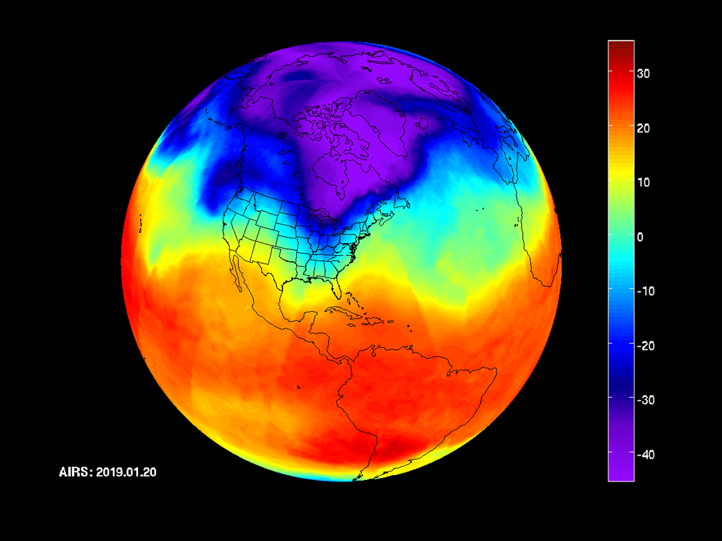 Environmental & Science Education
STEM
Earth Science
Earth Systems
Climate Change
Edward Hessler
For the past few years the upper midwest, including Minnesota, has been colder than average. In a recent Updraft entry, MPR's chief meteorologist notes that "Minnesota rides the eastern edge of the coldest place on earth relative to the 1981-2010 average. It shows up as a big blue blob across North America."
All of us know that the past five years have been record setting in terms of heat and yet here we are in 2019 shivering so early in the season. So why...what are some of the possible reasons for what is beginning to look like a persistently cool pattern? Huttner says that he is "not sure we have a clear answer...yet."
However, Huttner observes that there is a strong hint "in ocean temperatures in the North Pacific. The so-called 'blob' is a huge area of unusually warm ocean water in the North Pacific. It emerged in 2014 and has resurfaced again this year."
In addition, there are profound effects of this pattern in other places. Huttner cites Ian Livingston of the Capital Weather Gang who provides some examples: the persistent and intense California drought, blocked weather systems across western North America, hottest year in Seattle (2015), and as the blob sags south, the polar vortex weather of 2013-2014 and 2014-2015.
One of the takeaways is the V word--variation. Huttner closes by writing that "the big picture with climate change is that even as the globe as a whole gets measurably warmer, there are still regional variations. The last few years seem to suggest that one of those colder regions has set up across the middle of North America."
Huttner's essay is lavishly illustrated with helpful graphs, maps, statewide temperature trends for 2019, the blob in 2014 and so far in 2019, and a typical La Nina weather pattern. So why the latter? The blob mimics this pattern.
No comments:
Post a Comment